
Koh Tao
Sairee Beach, Koh Tao
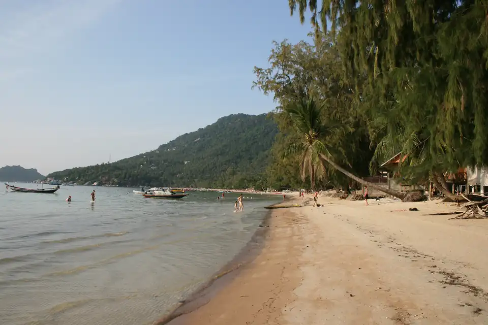
Two kilometres of west-facing sand with most of the island's dive schools behind it. It gets the sunset because of which way it faces, and it gets the roughest water this site measures in the Gulf because of the same thing.
Sairee is about two kilometres of sand down the west side of Koh Tao, and it is where the island lives. Most of the dive schools are on it or a street behind it, so are most of the places to eat, and so is the only stretch of Koh Tao you can walk end to end after dark without a torch.
Almost everything worth knowing about it follows from one fact: it faces west. That is why it has the sunset, and it is why it has the roughest water this site measures anywhere in the Gulf.
The beach itself
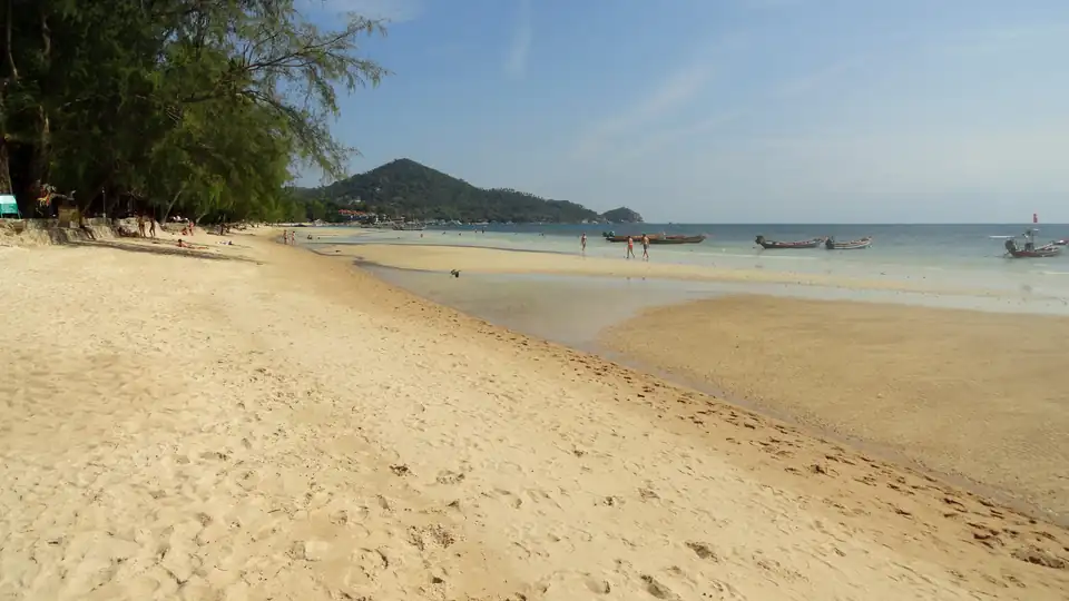
The sand is a long gentle curve backed by casuarina and palm, with the buildings set back behind them rather than on the sand. The water shelves very slowly, so it is knee-deep a long way out, which makes it easy for children and dull for anyone who wants to swim properly.
The boats are the real qualifier. Sairee is a working beach as well as a swimming one: long-tails and dive boats moor close in along the northern and central stretches, and the water there is a channel as much as a swimming area. The clean swimming is at the southern end, nearer Mae Haad, where the moorings thin out.
The strip behind it
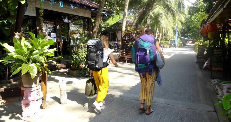
A narrow lane runs behind the beach for its whole length, and it is the reason to stay here. Dive schools, ticket agents, minimarts, laundries, bars and restaurants, one after another, with side paths down to the sand every fifty metres.
It is not pretty and it is extremely convenient. The competition among the dive schools is what makes Koh Tao cheap to learn in, and the reason they are all within a few hundred metres of each other is that they are all on this lane.
It also means noise. The northern and central stretches have bars that run late, and a room on the beach side of the lane will hear them. If you are certifying and have a seven o’clock boat, ask which side of the lane you are on before you book.
The sunset, and why it is here rather than anywhere else
Sairee is the only developed beach on Koh Tao that faces open water to the west, so it is the only one where the sun sets in front of you rather than behind a hill. Chalok Baan Kao faces south, the east-coast bays face the sunrise, and Mae Haad is a working port.
That single fact is why “Sairee sunset” is a thing people search for, and it is worth planning around in the most modest way: the bars along the sand price the front row accordingly, and the beach itself is free.
The sea, month by month
Four years of marine reanalysis at Sairee’s own coordinates, and it is a more interesting series than a beach this sheltered ought to have.
Calmest: April at 0.38 metres, with March at 0.44 and May at 0.42 close behind. Roughest: December at 0.89, November at 0.76 and January at 0.73. Those three are the roughest water this site measures anywhere in the Gulf, on any of its beaches.
The reason is the aspect again. The northeast monsoon runs down the Gulf from around November to January and Sairee is on the exposed side of the island for it, which is the same exposure that gives it the sunset. A west-facing beach in the Gulf pays for its evenings in December.
Two calendars, and why April wins
- Rainfall, millimetres per month
- Koh Samui, for comparison
Driest is February at 36mm over 5 rain days, wettest is October at 292mm over 26 rain days. Against Koh Samui, Koh Tao is wetter in 6 months of the twelve, and the largest gap is in June.
Koh Tao’s rain peaks in October at 292mm and November at 273mm, and by December it is back down to 123mm, which on a rainfall chart makes December look like the start of the good season.
By sea state December is the worst month of the year. That is the trap on this island, and it is the same one the island guide sets out: the rain calendar and the sea calendar are about a month apart, and for Koh Tao the sea matters more, because it is what cancels the ferry and what decides whether the dive boats go out.
Put the two together and April is the answer: 93mm of rain and the calmest sea of the year. March is the next best at 76mm and 0.44 metres. If you are here to certify, those two months are worth arranging a trip around.
Water temperature
The surface at Sairee runs between 28.0C in January and 31.4C in May. It is warm enough to dive in a shorty or a 3mm suit in any month, and the honest caveat is the one every dive page on this site carries: that is a surface figure. A diver at thirty metres is in colder water, and thermoclines on this coast in the dry season are a real thing rather than a rumour. Take the wetsuit the school recommends.
Where it is and how to get there
Address
Sairee Beach, Ko Tao, Ko Pha-Ngan District, Surat Thani, Thailand
ต.เกาะเต่า อ.เกาะพะงัน จ.สุราษฎร์ธานี
10.0973° N, 99.8271° E
Where it is
On Koh Tao's west-facing Gulf shore, 1.6 km north of Mae Haad pier, in a straight line.
Getting there
5 min 2.2 km by road from Mae Haad pier, with no traffic
Drive time and distance: OSRM over OpenStreetMap roads, to the road nearest the middle of the beach, free-flow, so a floor rather than a forecast. Address: official subdistrict boundaries (Royal Thai Survey Department, via OCHA) and Thailand Post.
Sairee, or somewhere else on the island
Stay on Sairee if it is your first visit, if you are doing a course, or if you would rather not hire a scooter. It is the only part of Koh Tao where everything is within walking distance.
Stay elsewhere if you want quiet. Chalok Baan Kao in the south is calmer and has the shallow bay; the east-coast bays at Tanote, Hin Wong and Ao Leuk are properly away from it and need transport for every meal.
The island as a whole, including the crossing and which months the boats stop, is on the Koh Tao guide.
Sairee Beach, Koh Tao FAQs
Is Sairee Beach worth staying on?+
For a first visit to Koh Tao, and for anyone doing a dive course, yes. It is where the schools, the food and the evening are, and it is the only part of the island where you do not need a scooter to have dinner. If you want quiet, Chalok Baan Kao or the east coast are the answer instead.
Can you swim at Sairee Beach?+
Yes, and it is shallow a long way out, which suits some people and frustrates others. The caution is the boats: the northern and central stretches have long-tails and dive boats moored close in, so the clear swimming is at the southern end, away from the moorings.
Why is Sairee famous for sunset?+
Because of which way it faces. Sairee runs down Koh Tao's west coast, so the sun sets over open water in front of it, which is not true of any other developed beach on the island. That is also why it takes the brunt of the northeast monsoon swell in December.
When is the sea calmest at Sairee?+
April, at 0.38 metres of mean daily-maximum wave height, with March at 0.44 close behind. The roughest is December at 0.89, then November at 0.76 and January at 0.73, which are the three roughest months this site measures anywhere in the Gulf.
How warm is the water at Sairee Beach?+
Between 28.0C in January and 31.4C in May, from four years of marine reanalysis. It is warm enough to dive in a shorty all year, and the caveat is the same as everywhere: that is a surface figure, and a diver at thirty metres is in colder water.
What is the best month for Sairee Beach?+
April. It is the calmest sea of the year at 0.38 metres and one of the drier months at 93mm, which is a combination the rest of the calendar does not offer. March is the next best. December looks dry on a rainfall chart at 123mm and has the roughest water of the year.